Top 14 Weather Photos of 2014
For the past few years, I’ve been posting a ‘top 10’ list of my storm photos form the previous 12 months. Usually, all of them come from spring and summer, but there was such a wide variety of amazing weather events that spanned the entire year, I had to expand my list to fit them all in. So here are my top 14 weather photos from 2014!
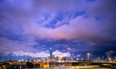
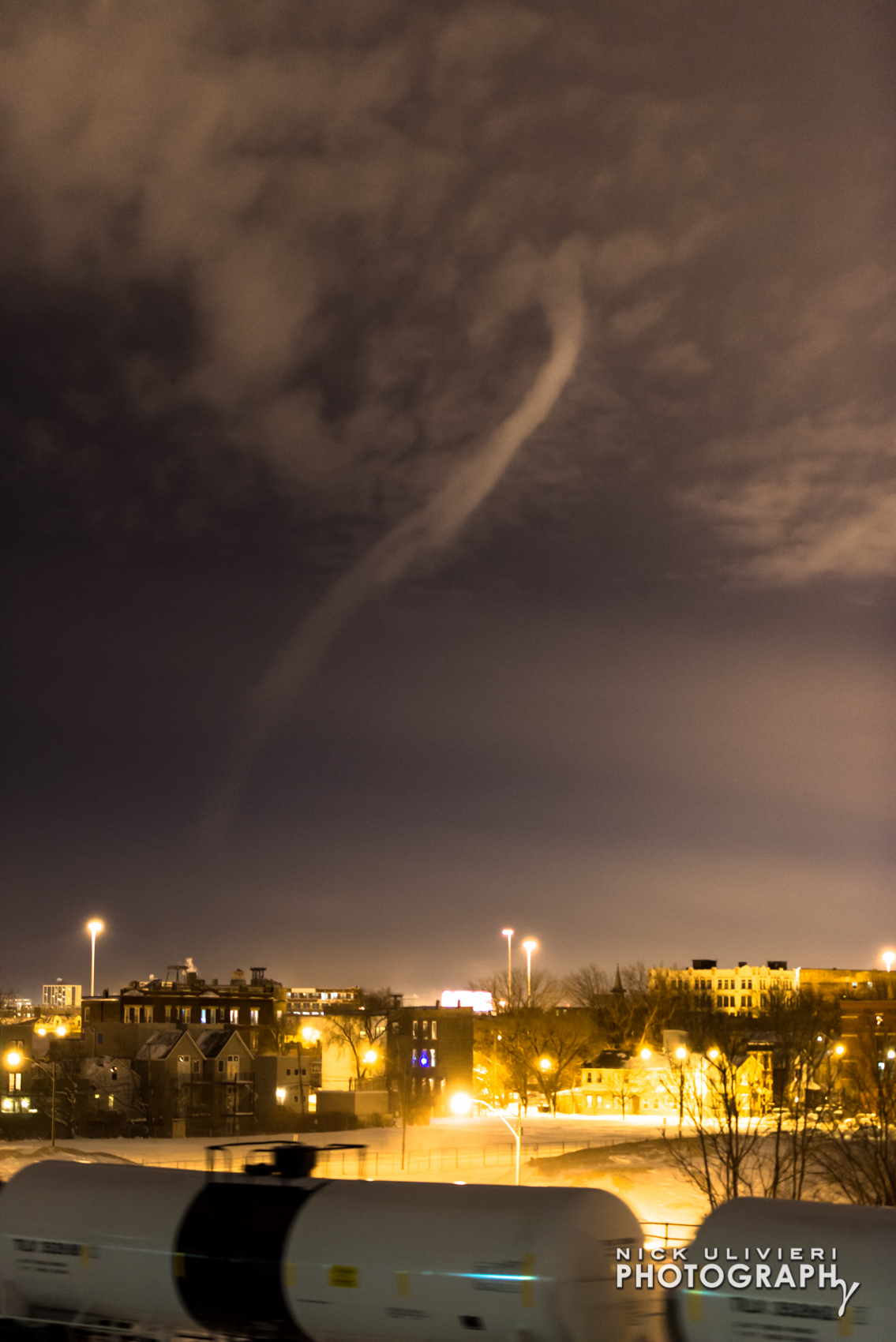
1. January 5th – The Polar Vortex grips Chicago: A cold-air funnel/potential water spot descends from the sky as temperatures plummet. I’ve never seen anything like it, and don’t know if I ever will again.
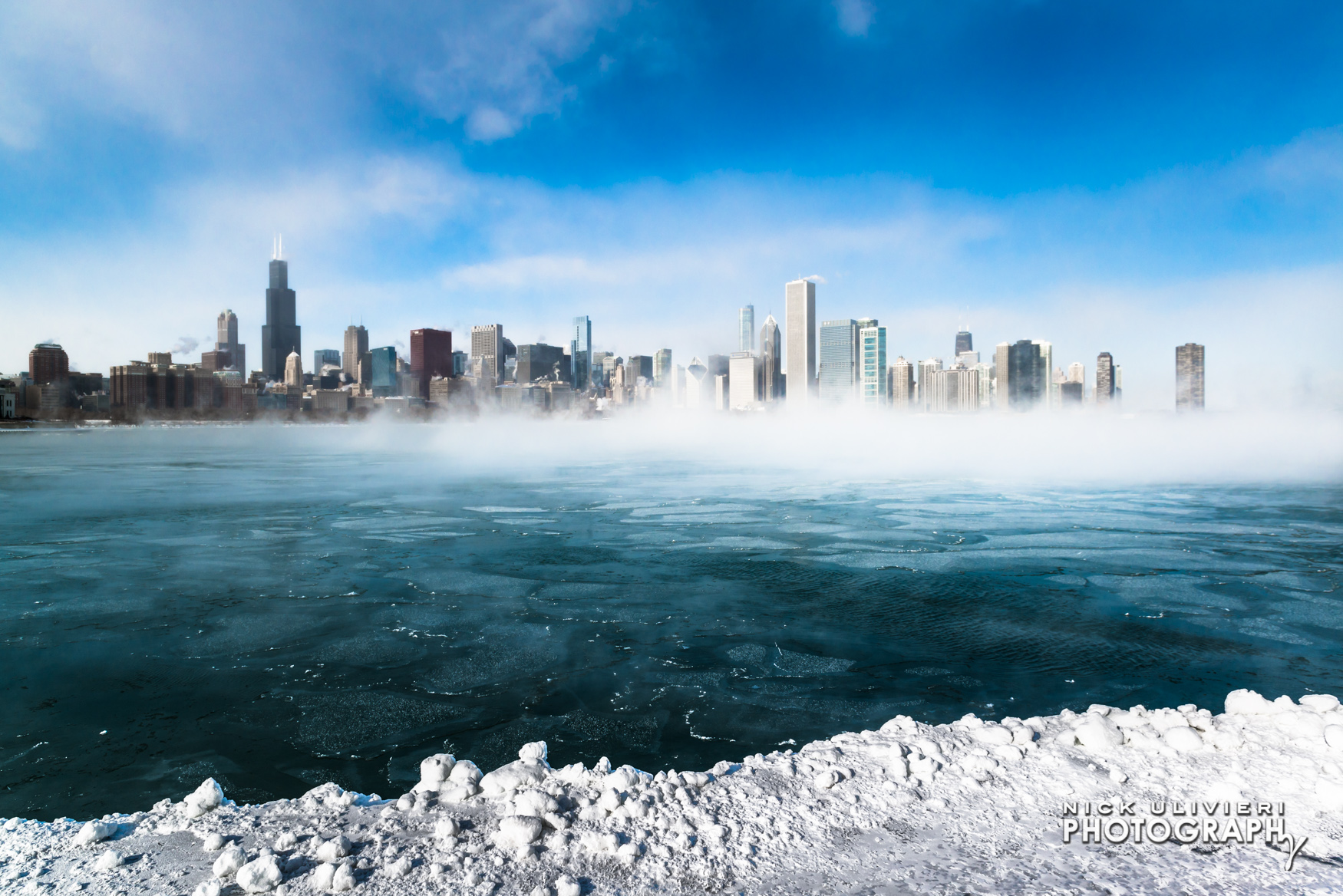
2. January 6th – The extremely cold temperatures brought in by the arctic air and high winds caused the relatively warm water to condense immediately into small ice crystals. In effect, it was snowing upwards. You can read more about my polar vortex experience here.
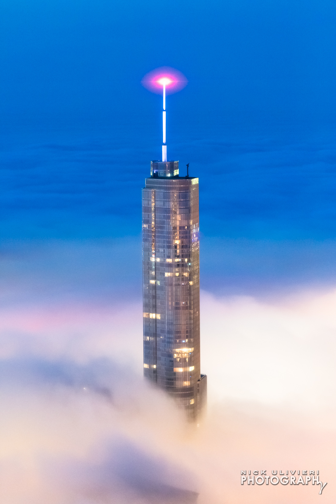
3. June 6th – There were some incredible bouts of fog this summer and we have have the extreme cold winter to thank. The extended stay of the polar vortex created a surprisingly cold lake, and when warm easterly winds began to flow in late spring and early summer, we were treated to some ethereal scenes. This is what the fog looked like from Skydeck.
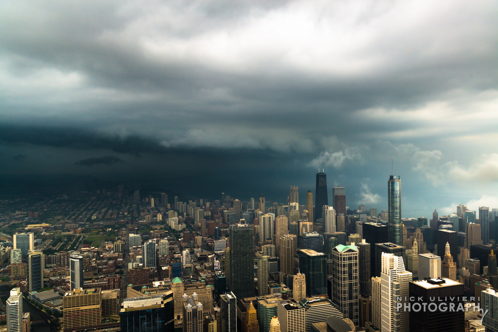
4. June 18th – I spent a lot of time at Skydeck this summer. It’s an amazing vantage point to watch storms roll in. Watching this shelf cloud roll in from the northwest was pretty spectacular.
5. June 19th – I was back at Skydeck the next night in hopes of catching another storm. I definitley lucked out with this bolt. There wasn’t a ton of lighting that night, but I managed to catch a few others, too.
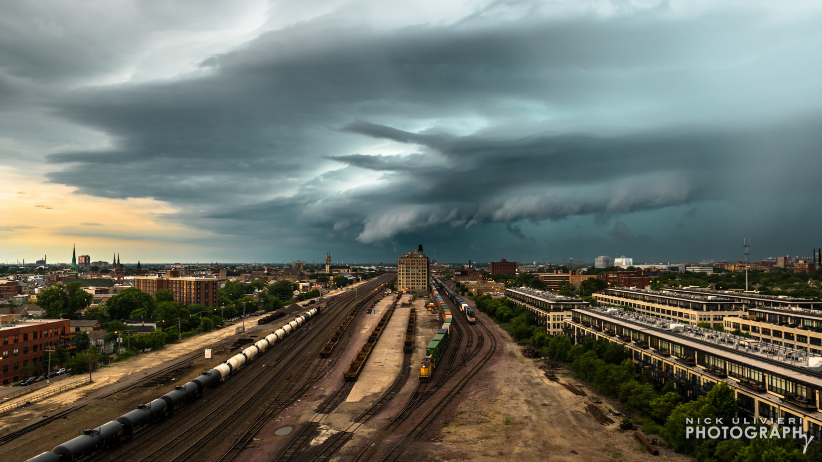
6. June 21st – A distant shelf cloud from my building’s rooftop is a sign of a good day at the office.
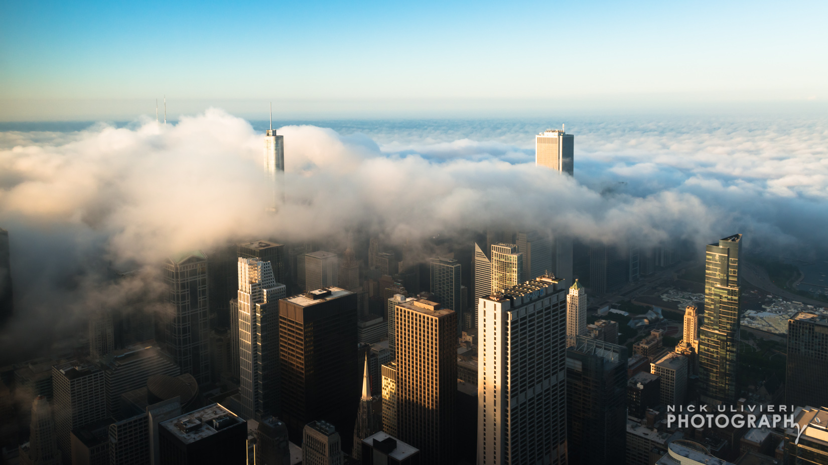
7. June 22nd – The fog was back and I hopped a ride with Rotorzen to catch it from above. This was one of the most memorable shoots I’ve ever done.
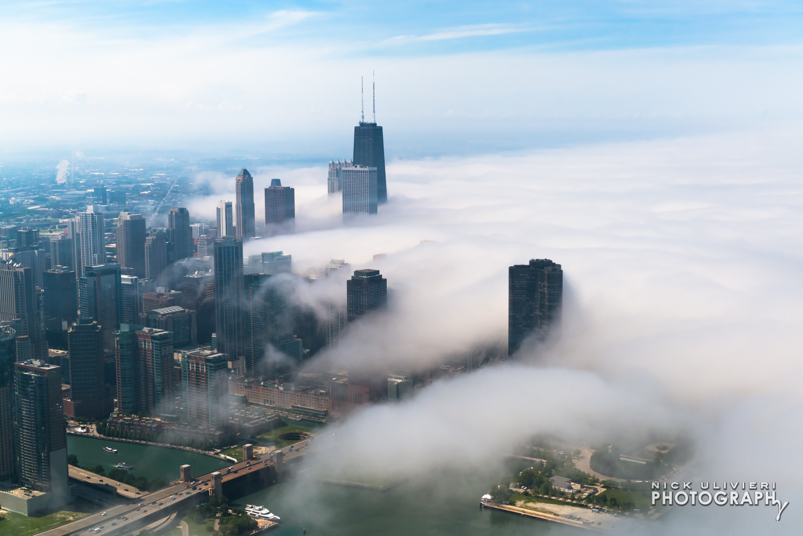
8. June 26th – Another day of fog! This time, it settled in over the city at dusk and I ventured up to Skydeck to catch it again. It looked so cool being underlie by the city lights. If you want to see more of my fog shots from this summer, check out this set.
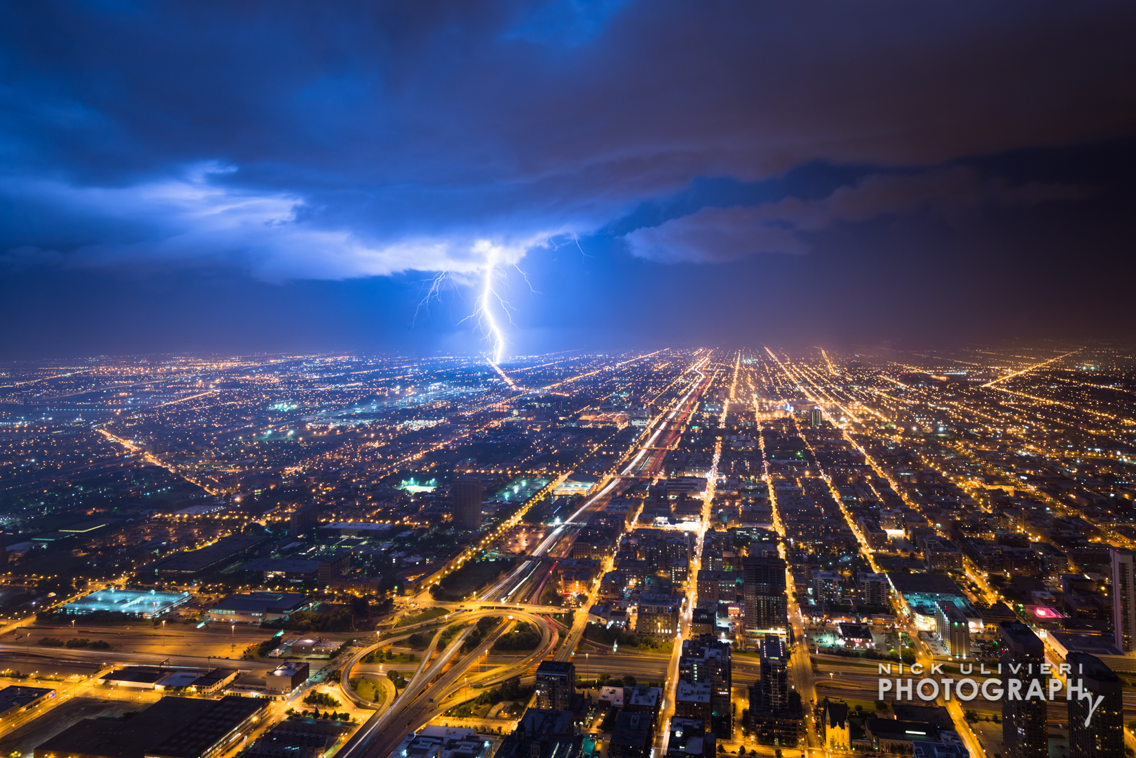
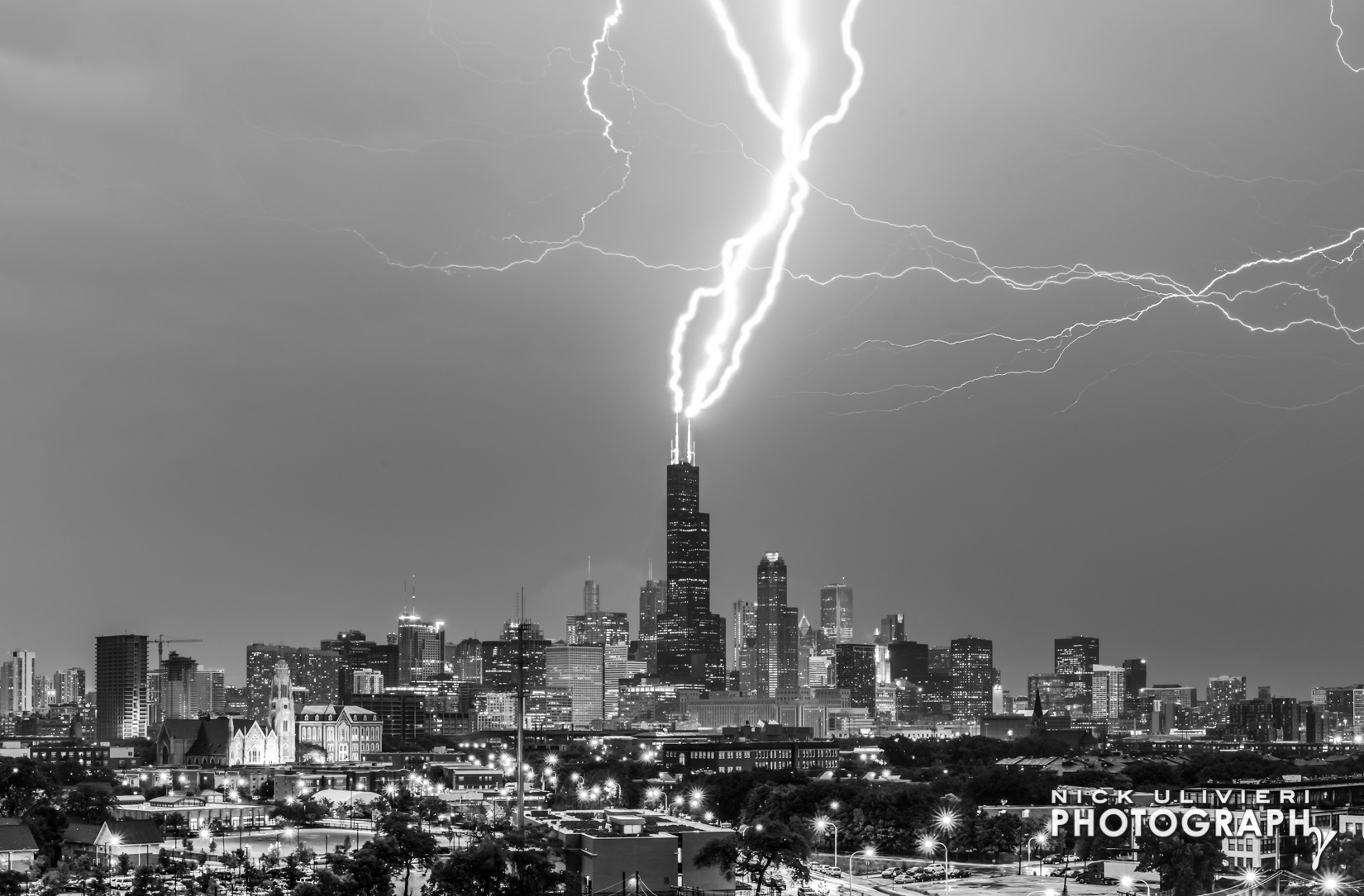
9. June 30th – On this date, a powerful derecho ripped across the midwest. This shot is a composite of three separate lighting strikes taken approximately 40 minutes apart.
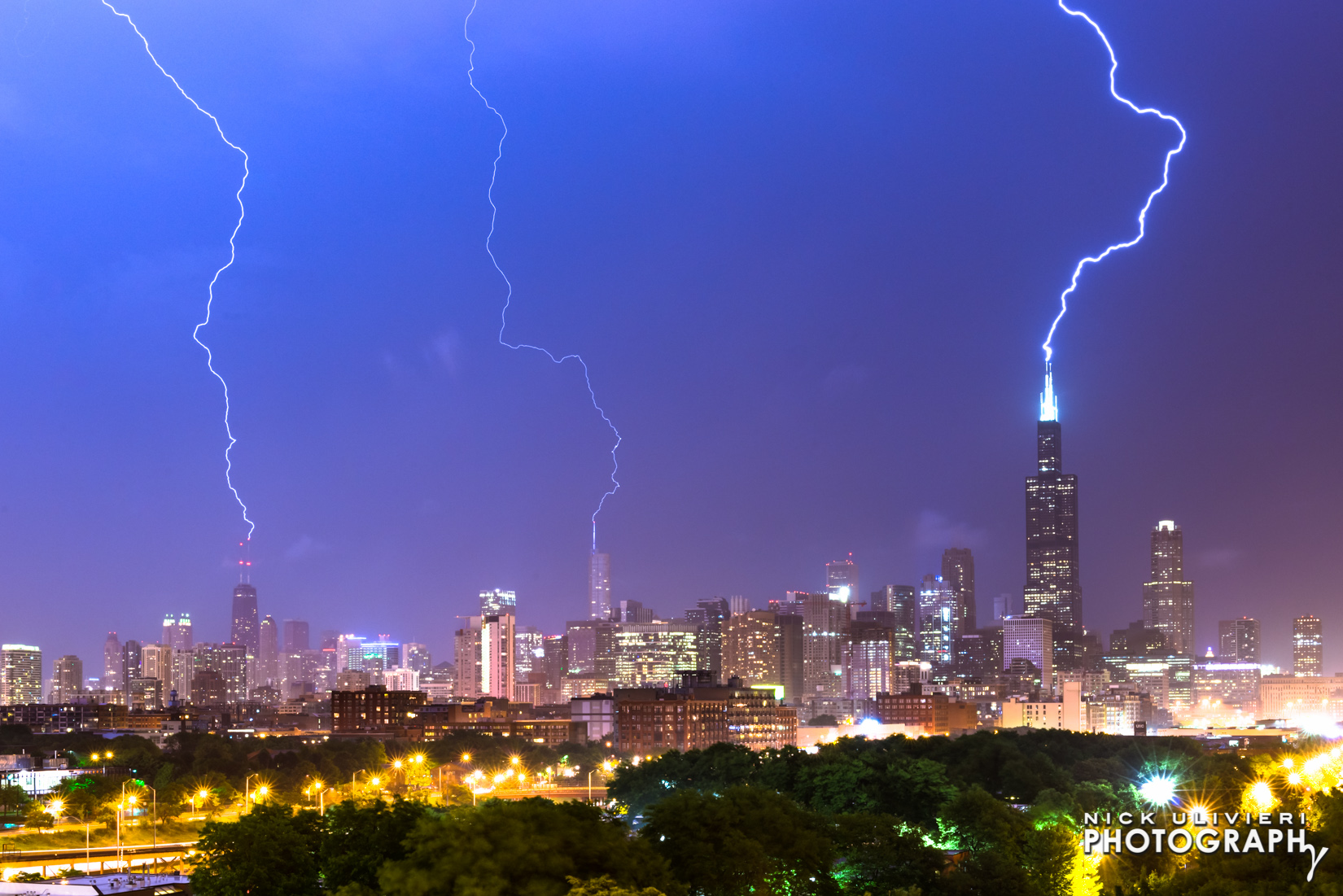
10. July 12th – This storm didn’t produce much lighting, but a great vantage point, and great timing allowed me to capture all three bolts striking Chicago’s tallest antennae in a single frame.
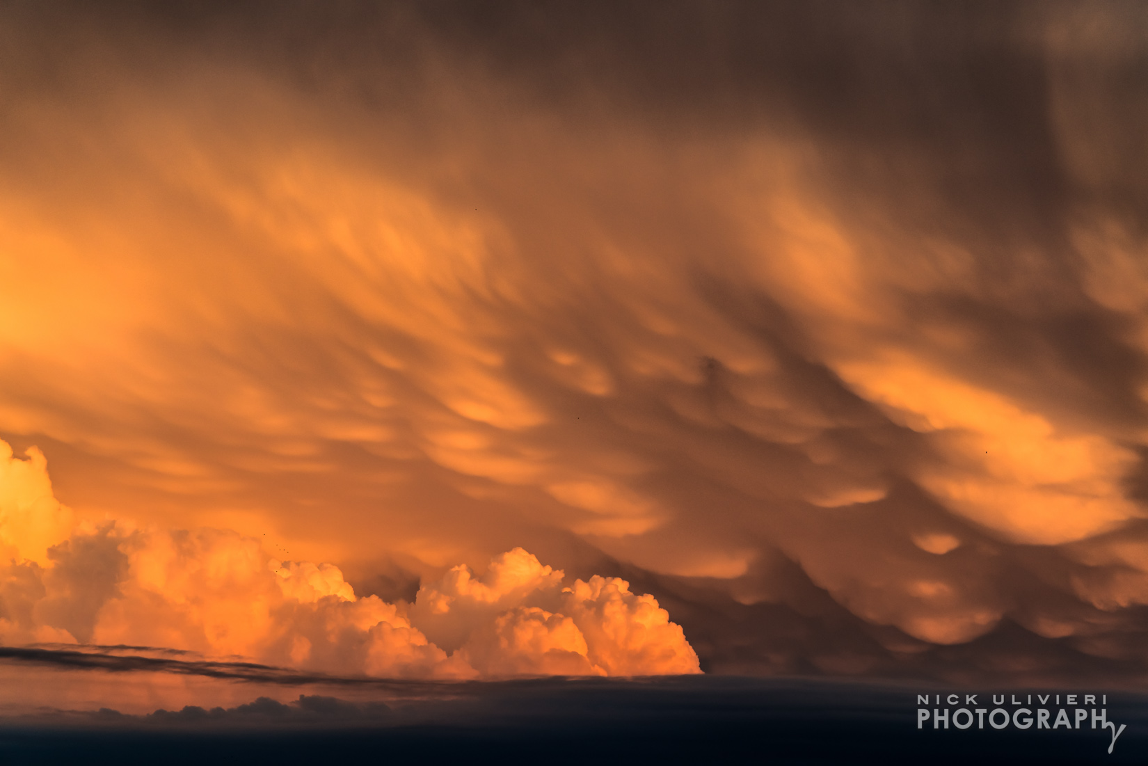
11. August 30th – This sky didn’t produce a storm here in Chicago, but the mammatus clouds underlit by the setting sun was a sign of powerful storms impacting central Illinois and Indiana.
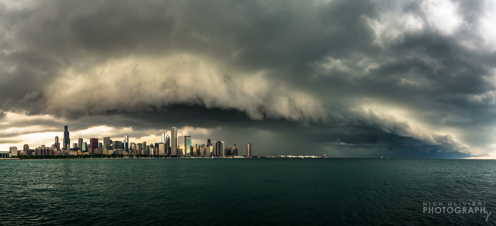
12. September 5th – I’ve wanted to capture a shelf-cloud from this vantage point for years, and a big storm system in early September gave me that chance. Here’s an ultra-wide, 3-frame panorama as seen from out front of the Adler Planetarium.
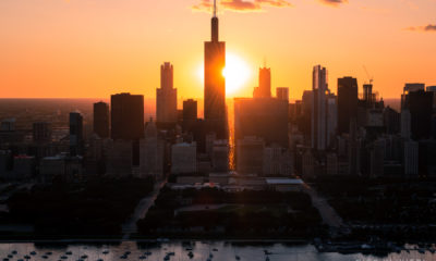
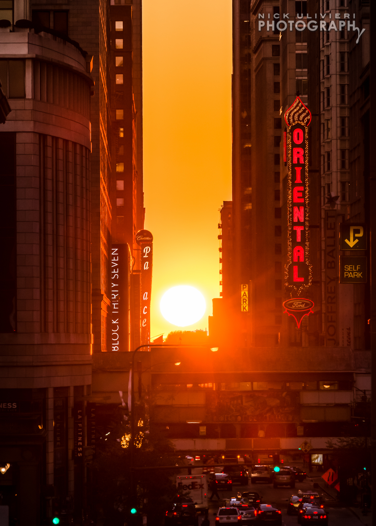
13. September 22nd – Oddly enough, this shot features a perfectly clear day. Usually pretty boring for photographers, but on the autumnal equinox when there are no clouds, the setting sun turns the concrete canyons of Chicago into a Stonehenge monument of sorts – around here, we call it Chicagohenge.
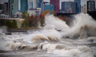
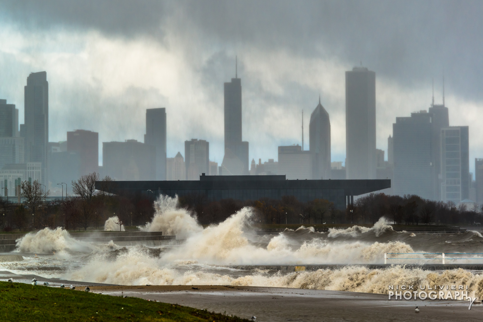
14. October 31st – Powerful waves pummeled the lakeshore on Halloween. The shooting conditions were brutal, but the photos they produced were pretty amazing. If you want to see more shots of the waves check them out here.
Thanks for checking out these photos – Can’t wait to see what 2015 brings! Cheers!