April Storms
It’s been a busy start to storm season here at NUPHQ (I.e. our balcony). Since moving to our new home in Pilsen – with a north-facing skyline view – I’ve been eagerly awaiting the start of the spring storm season. We moved here last June, but there weren’t many photogenic storms to be had. But, 2023 is off to an incredible start.
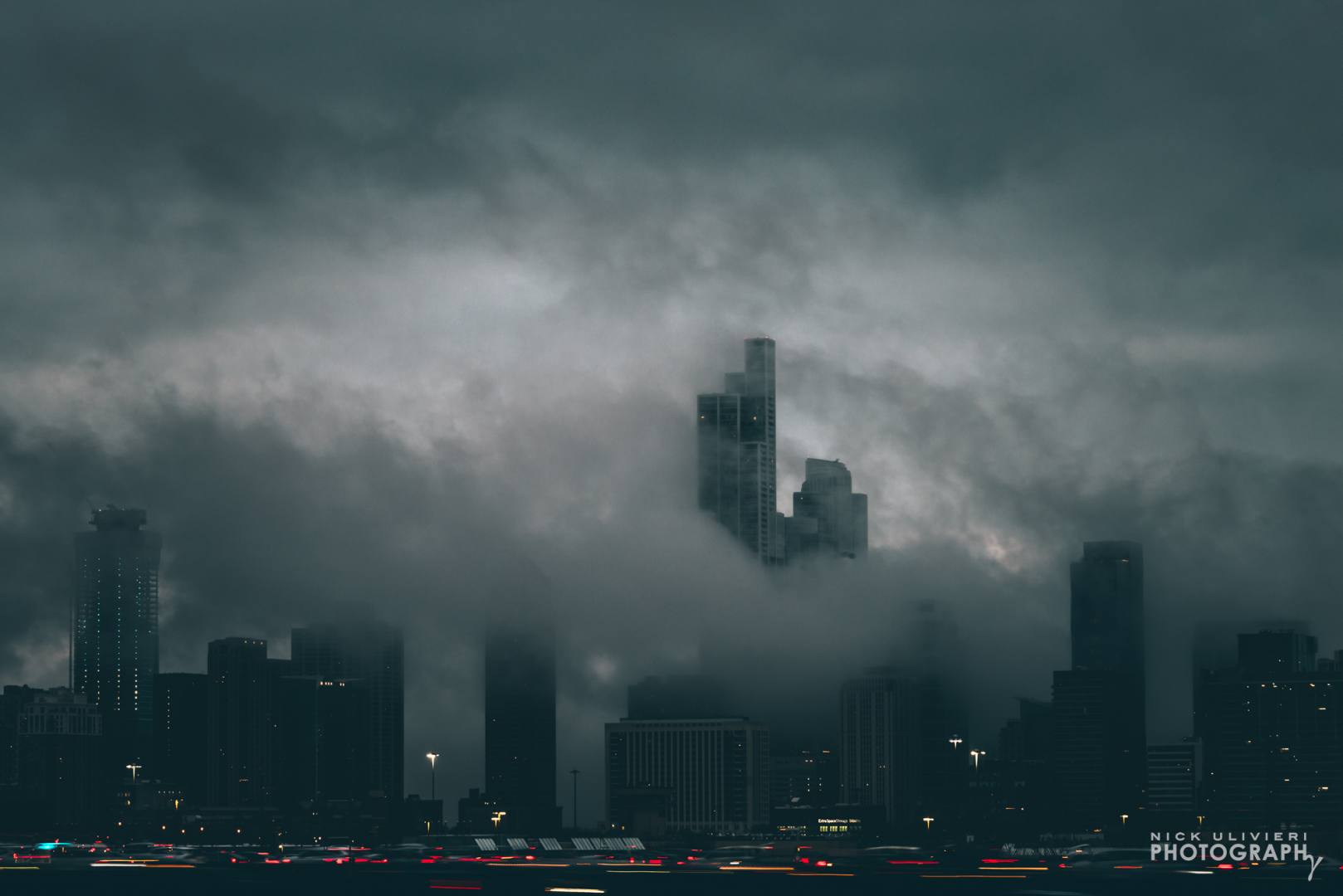
March 31st:
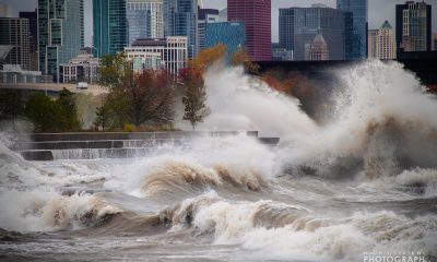
A powerful storm swept across the Midwest – generating 22 tornados in Illinois alone! While the severe storms missed Chicago, some turbulent skies appeared above the city. Granted, this happened in March, but I consider it an appetizer for April.
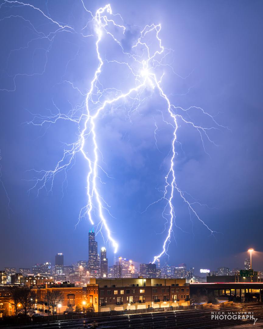
April 4th:
A few days later, storm chances reappeared. By all accounts the storm was far less severe than what traversed the region a few night prior, but it still packed a punch. This time, Chicago did get in on the action. Lighting was infrequent, but my shutter was open at just the right time to catch these massive bolts dropping onto three of the city’s skyscrapers. This is a single exposure – no compositing here.
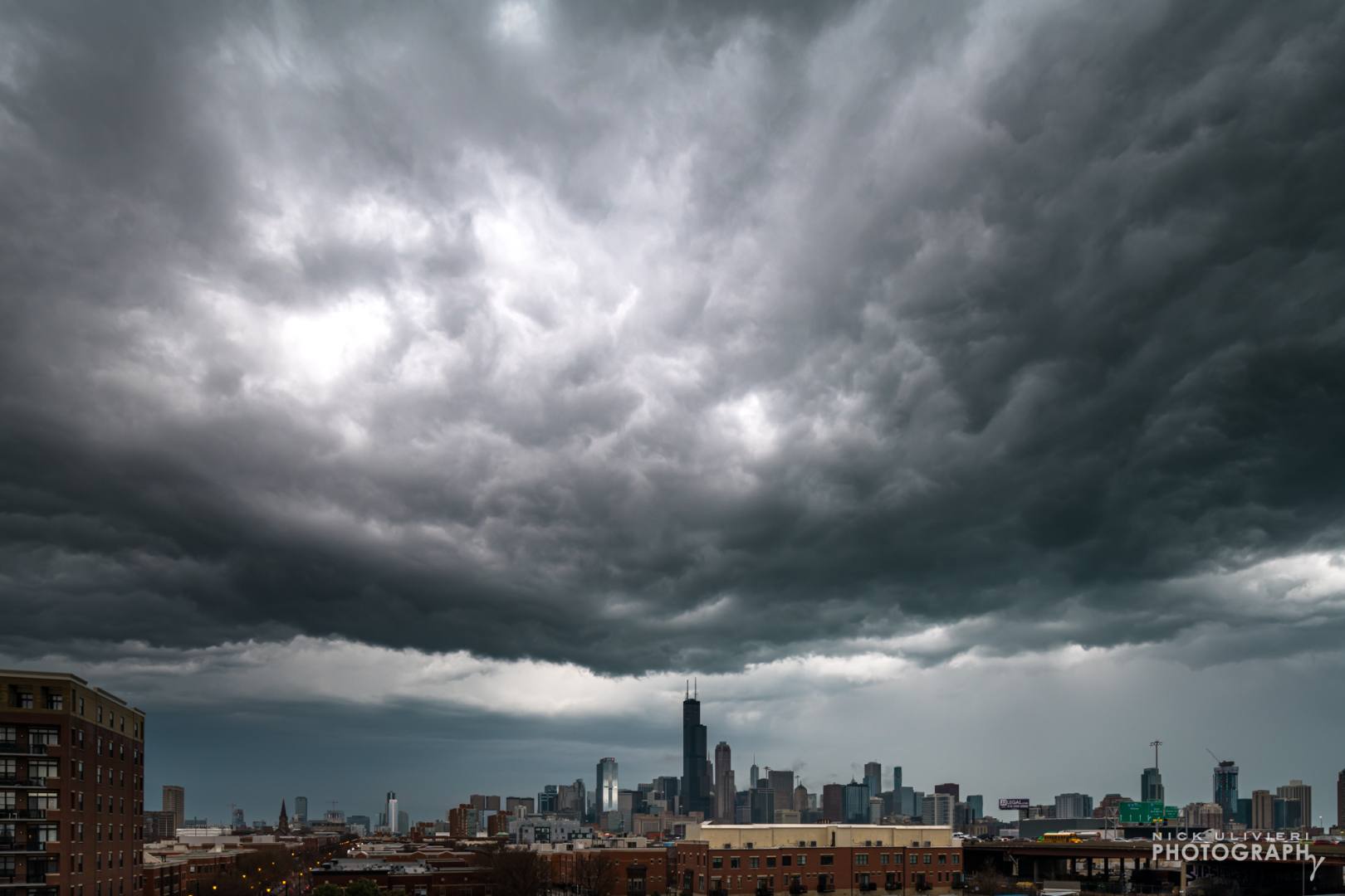
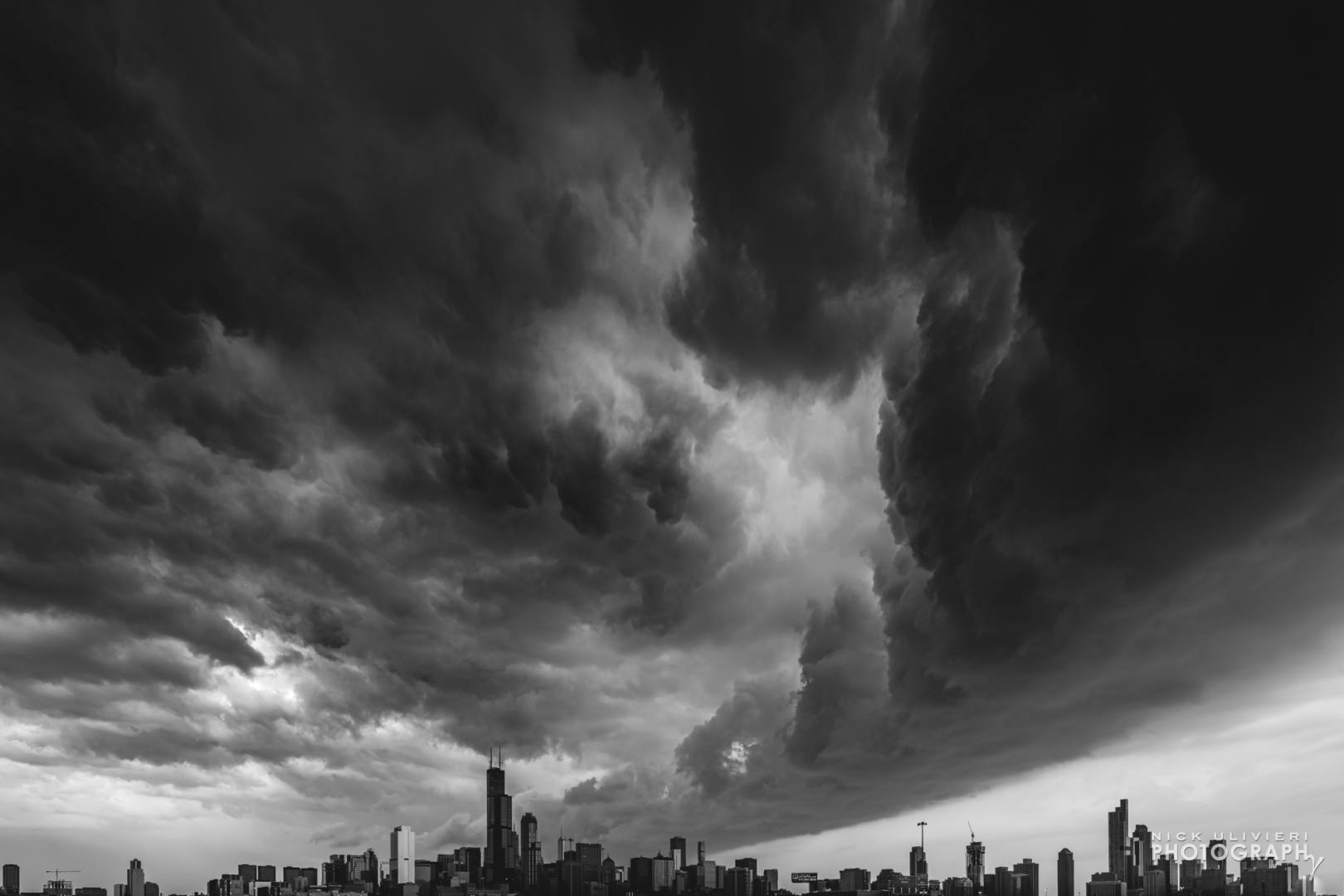
April 5th:
After an electrifying night, the following morning yielded a surprise as well. A shelf cloud! When I woke up, the skies looked dark. naturally I checked the radar and saw a well defined bow sliding towards the city. Luckily I still had my gear out from the night before, and I was able to make this shot as the front of the shelf passed overhead. I cropped this one to purposefully remove the foreground so the monstrous clouds would dwarf the skyline.
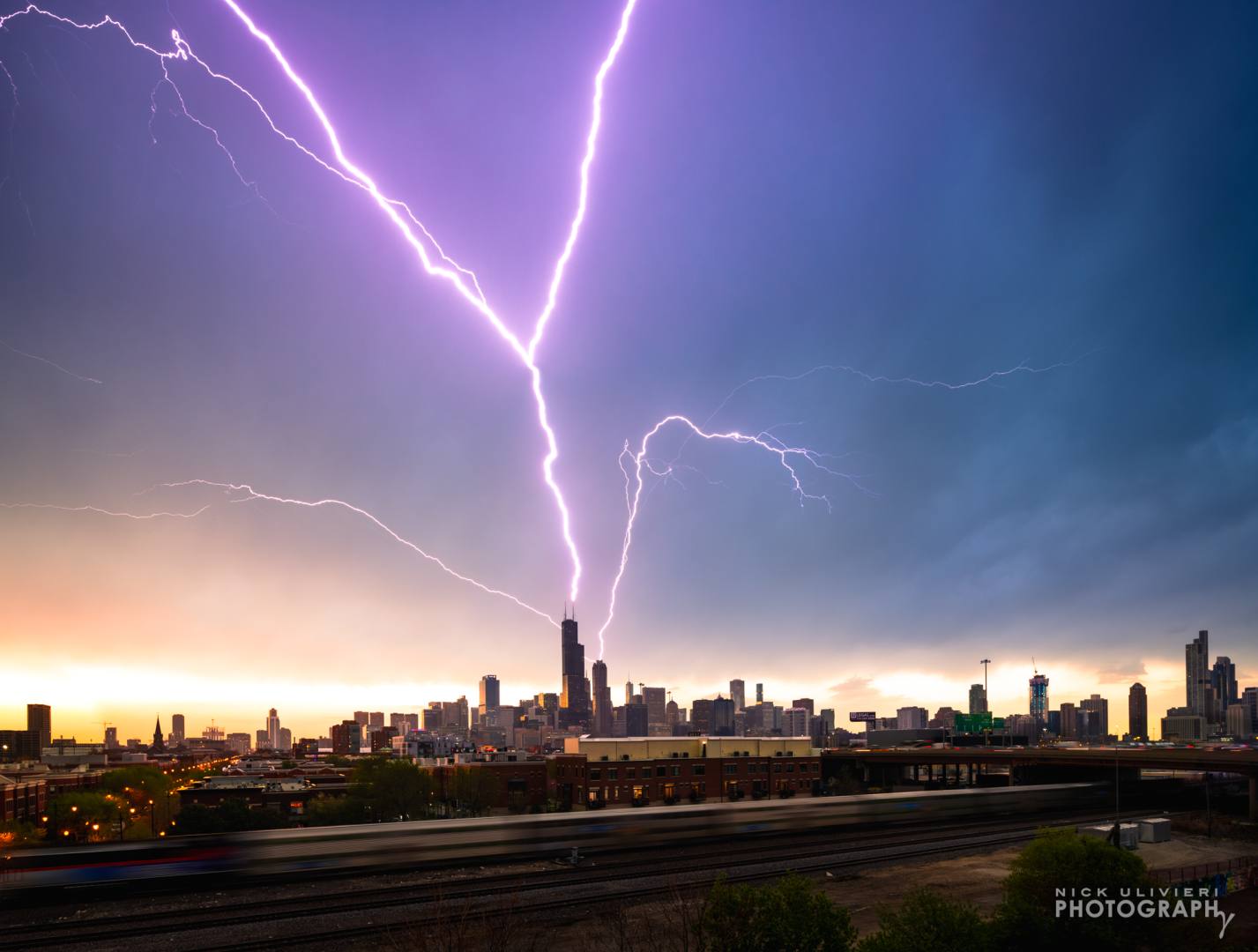
April 19th:
The weather calmed down for about two weeks, but on the 19th another thunderstorm blew into town. The featured image of this blog post is my top shot from the evening. This is an interesting image. It’s a composite of three lighting frames…of the same bolt, and one frame of the train. The lightning flashed and pulsed for nearly half a second and my camera caught the bolt’s evolution in three sequential 1/8 second frames (pictured below). Since I was using my tilt-shift lens, I then shifted my lens down in order to catch a train to add more foreground context. 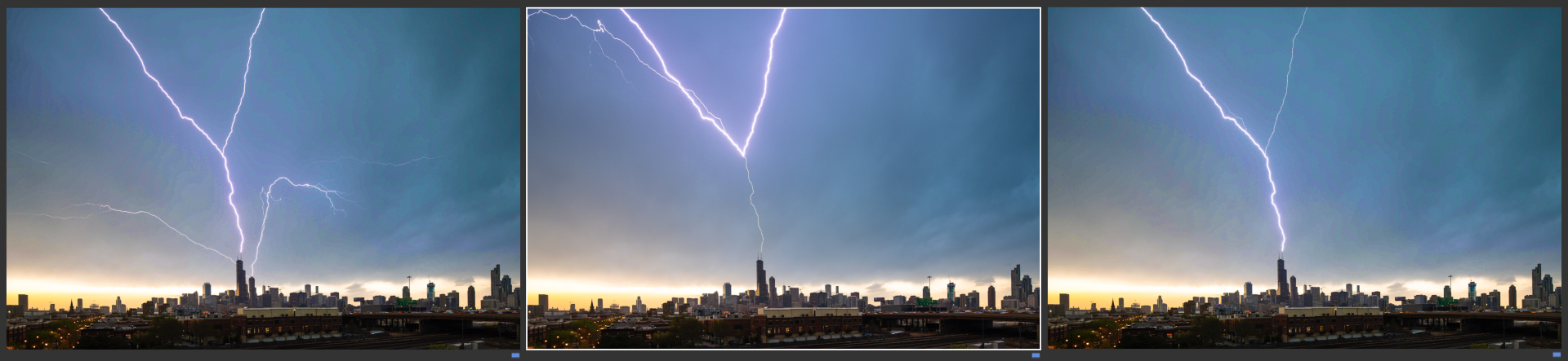
Big thanks to my friends at GMA for the feature & clip: Ginger Zee, Max Golembo, and Sam Wnek
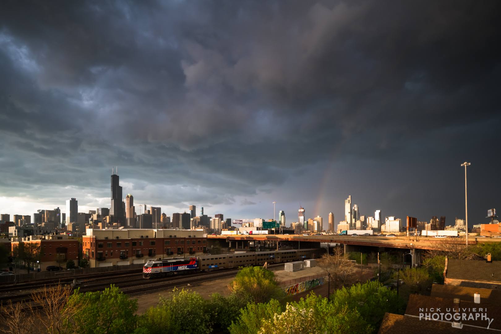
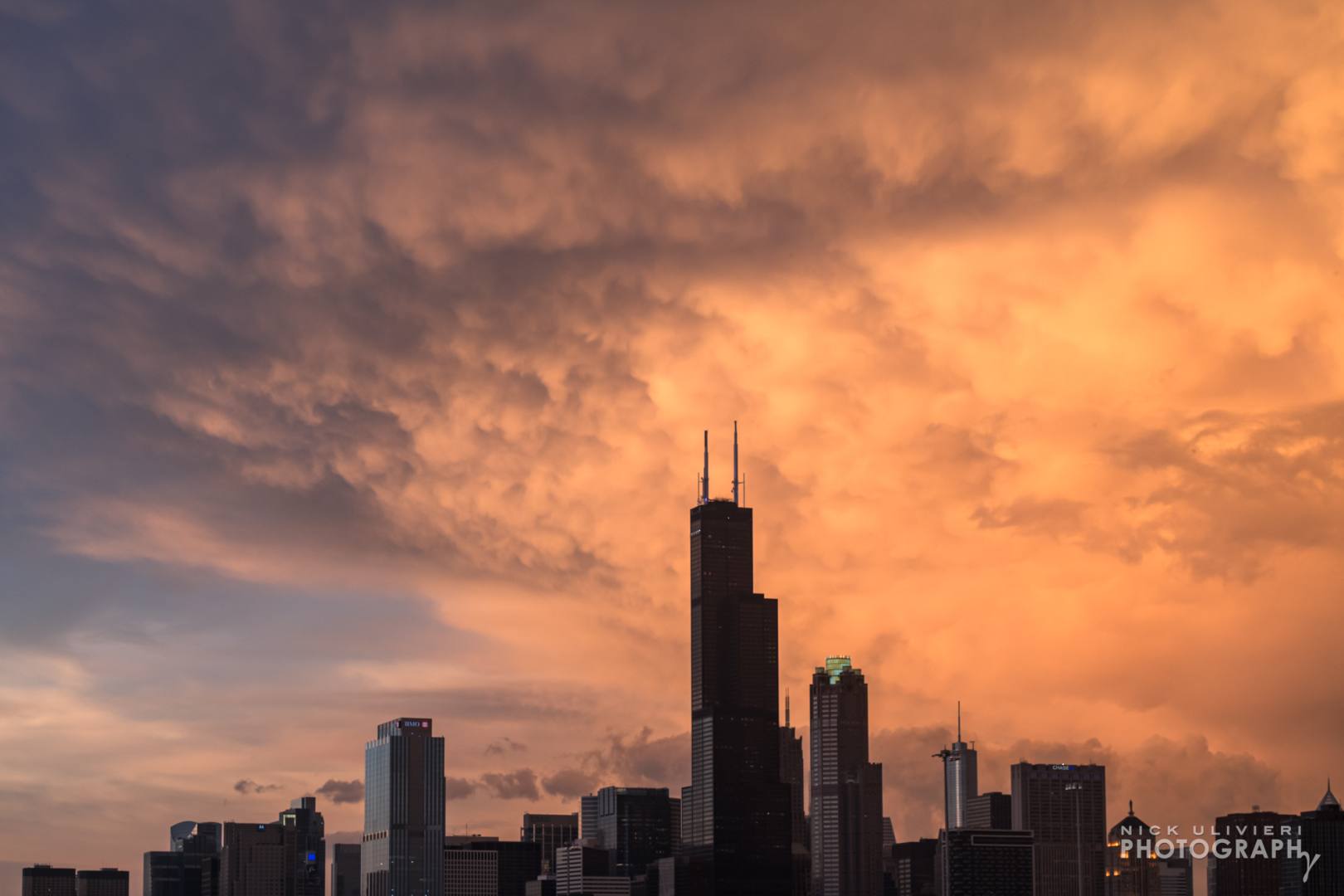
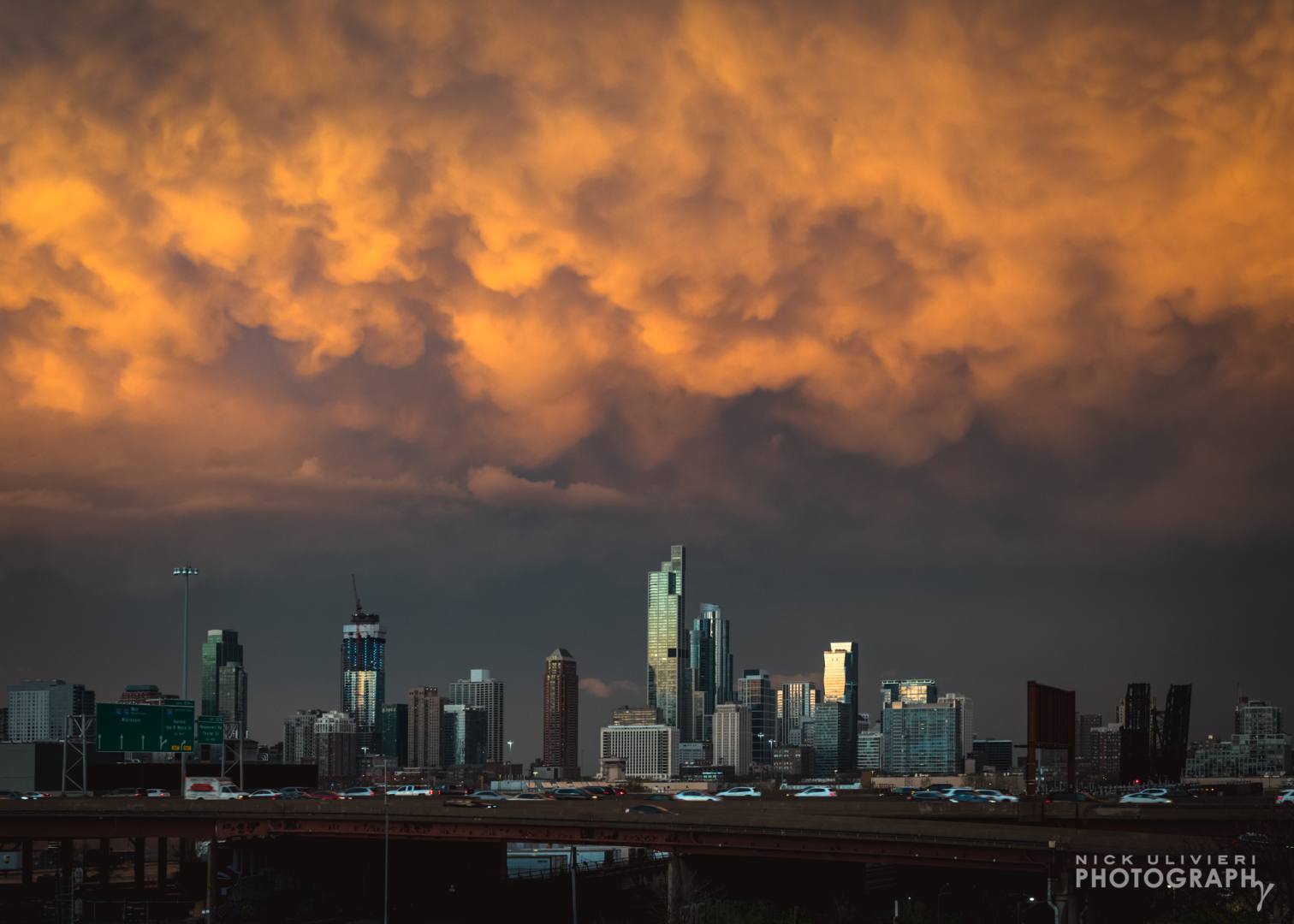
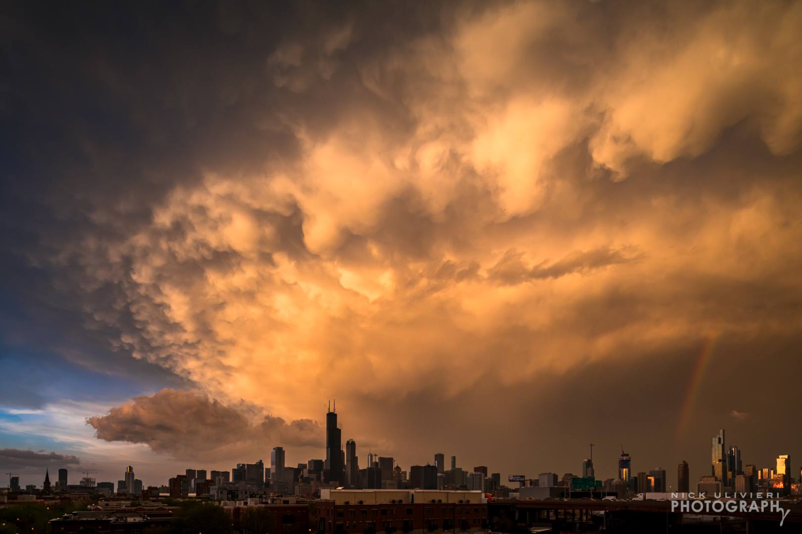
April 20th:
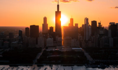
Once again, the day after the lightning show more rounds of storms were in the forecast. After a rainy morning, the skies cleared and the sun appeared, adding energy to the impending system. I watch the storm approach on radar – laden with lightning. But as it got closer, the storm appeared to bifurcate with stronger cells heading north and south of the city. Lighting activity dropped. It was clear we weren’t going to get another light show. But. But! The light was weird. At the same time a light rain began to fall, the sun started to appear in the western sky. A faint rainbow appeared.
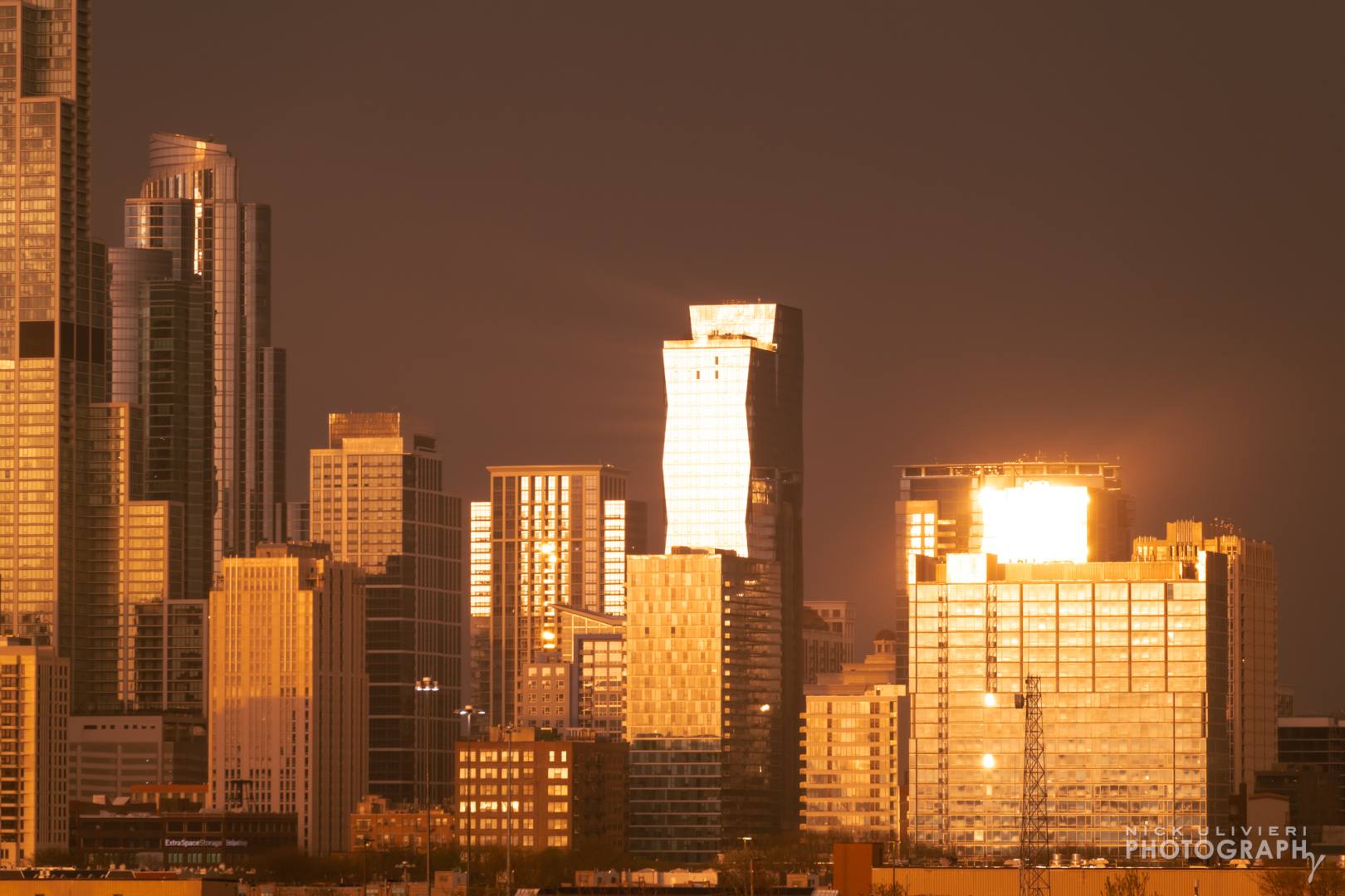
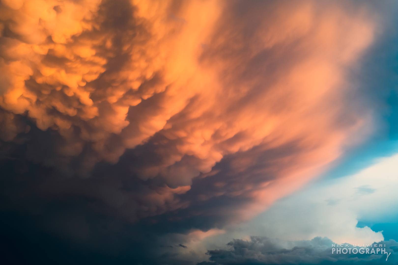
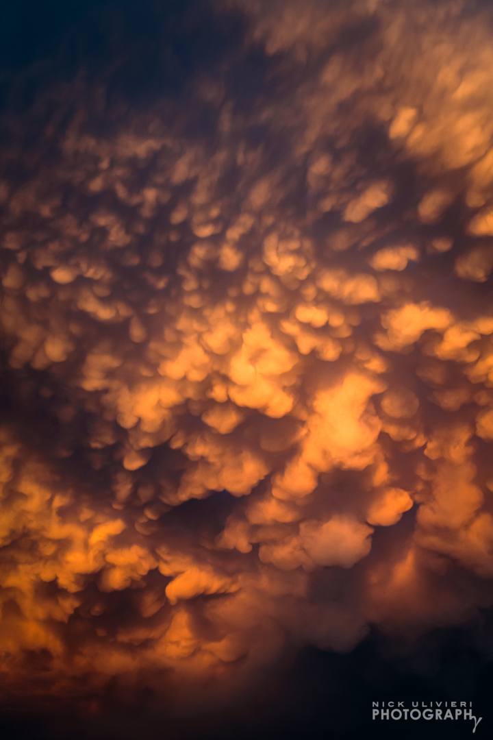
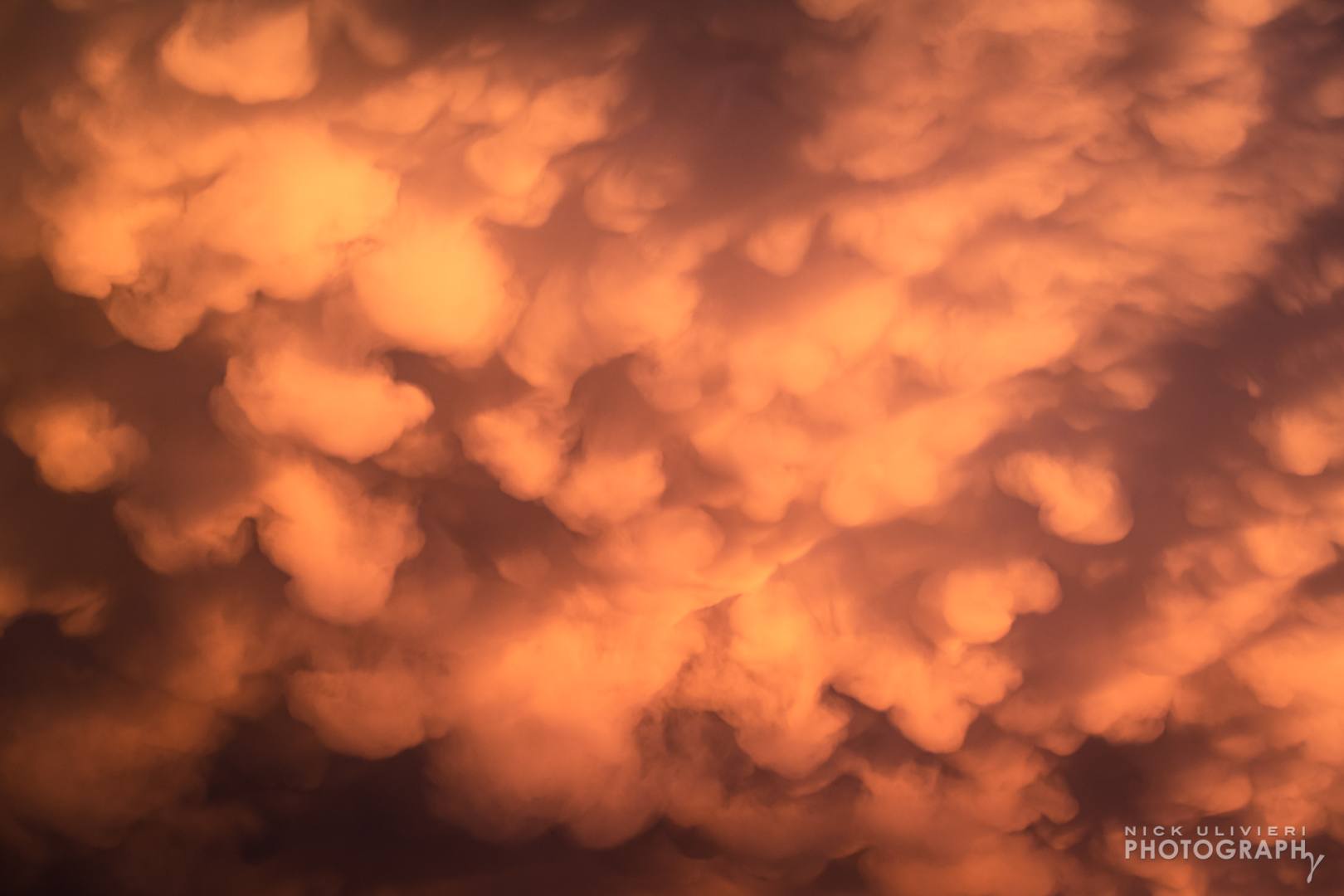
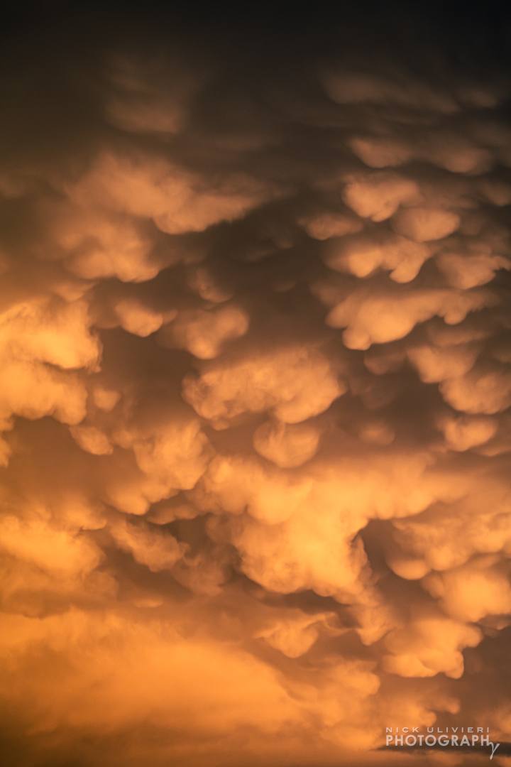
Anytime you have dark, stormy skies above and bright, clear skies behind – particularly near sunset – there’s a good chance interesting things are about to happen. And they did. As the storm system passed overhead, the descending sun began to shine under the thunderstorm’s ‘anvil.’ This under lighting illuminated a fantastic mammatus cloud display. To see mammatus clouds this well-defined is relatively rare in our region. Check out these wide and telephoto shots of the clouds and their insane texture. In some ways mammatus clouds are better than lightning because they can be enjoyed for more than a split second.
